How to Stop Wasting Time Measuring Properties and Start Winning More Landscaping Jobs
Boost your landscaping business with automated satellite estimating! Save time, reduce costs, and win more jobs with accurate, remote bids.
How to Stop Wasting Time Measuring Properties and Start Winning More Landscaping Jobs
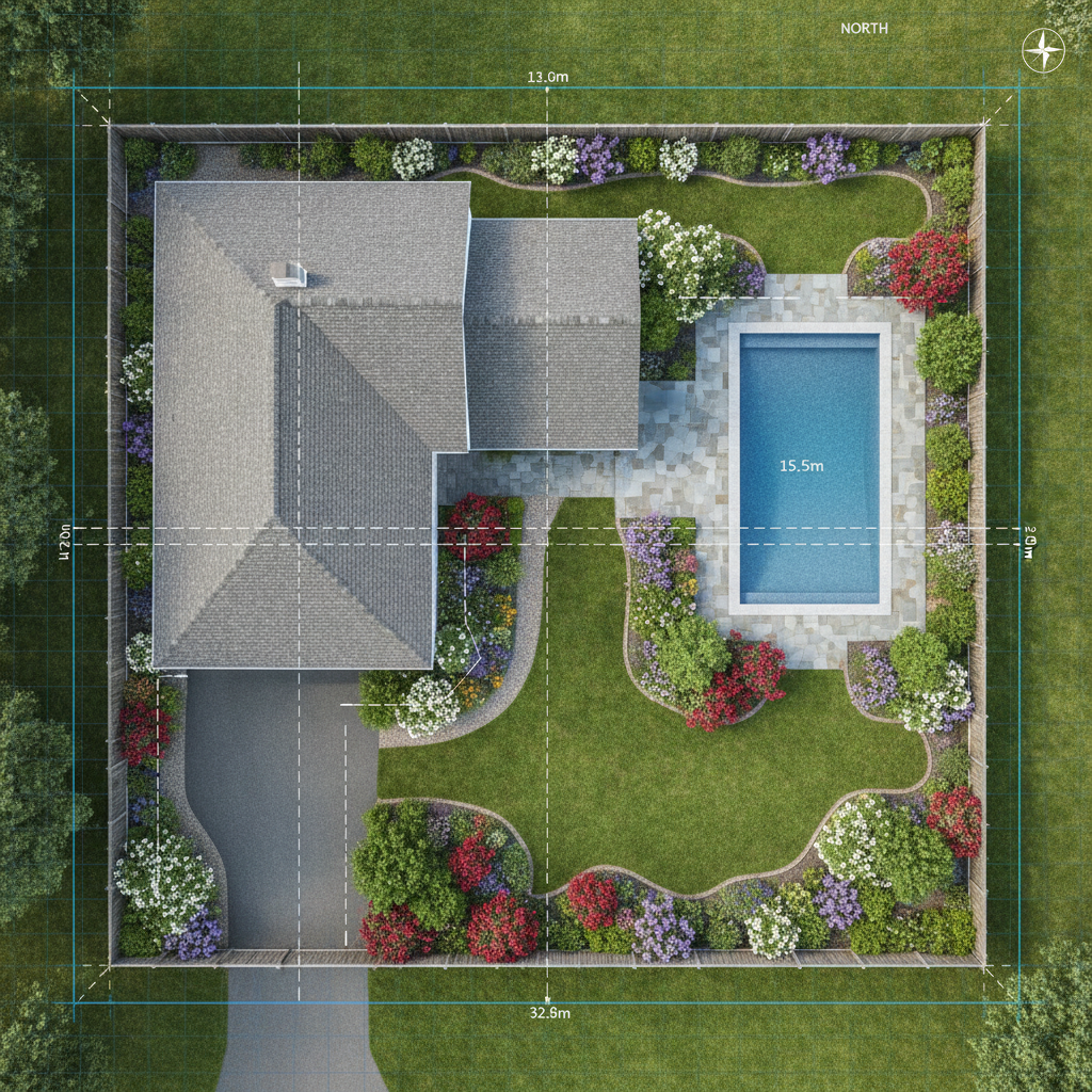
TL;DR: Automated satellite estimating uses aerial imagery and specialized software to quickly measure properties for landscaping and lawn care estimates. This saves time, improves accuracy, and allows for remote bidding lawn care jobs. Key benefits include reduced travel, consistent measurements, and faster proposal generation.
Automated Satellite Estimating: Your Guide to Faster, Smarter Bids
Tired of spending hours measuring properties or relying on rough estimates? Automated satellite estimating is a game-changer for landscaping and lawn care businesses. It leverages the power of technology to deliver precise measurements from your computer.
This guide will walk you through how to implement and benefit from this powerful approach. You'll learn how to get accurate bids out the door faster.
What is Automated Satellite Estimating?
It's a method that uses satellite property measurement software to analyze aerial imagery of a property. This software then automatically calculates dimensions like square footage, linear feet, and even tree counts. These measurements are crucial for creating accurate automated landscaping estimates.
Think of it as having a virtual tape measure at your fingertips. You can assess a property's needs without ever setting foot on it.
How Does It Work?
The process is surprisingly straightforward. You input an address into the software. The system then accesses high-resolution aerial or satellite images of that property.
Sophisticated algorithms analyze these images. They identify property boundaries, structures, and existing landscape features. The result is a detailed digital map with precise measurements.
Benefits for Your Landscaping Business
- Speed: Generate estimates in minutes, not hours. This means more bids submitted and more jobs won.
- Accuracy: Eliminate human error in manual measurements. Get consistent, reliable data every time.
- Cost Savings: Reduce travel time and fuel costs associated with site visits.
- Professionalism: Present clients with clear, detailed proposals based on precise measurements.
- Competitive Edge: Offer faster response times and more accurate quotes than competitors.
[!IMPORTANT] Automated landscaping estimates are not just about speed; they are about providing a more professional and data-driven service to your clients.
Getting Started: The Essential Steps
1. Choose the Right Software
This is your most critical decision. Several excellent satellite property measurement software options are available.
- PropertyIntel: A leading platform known for its user-friendly interface and comprehensive measurement tools specifically for the green industry. It integrates well with existing CRM and estimating systems.
- DroneDeploy: While often associated with drone data, it also offers robust mapping and measurement capabilities from aerial imagery. It's powerful for more complex site analysis.
- GIS Software (e.g., ArcGIS, QGIS): These are more advanced tools that offer extensive spatial analysis features. They might require a steeper learning curve but provide unparalleled customization.
[!TIP] When evaluating satellite takeoff software pricing, consider not just the monthly fee but the features included, the ease of use, and the potential ROI in saved time and increased sales.
2. Understand Your Software's Features
Each platform has unique strengths. Familiarize yourself with:
- Measurement Tools: Square footage, linear feet, acreage, slope analysis.
- Data Layers: Ability to overlay existing utilities, property lines, or even tree canopy data.
- Integration Capabilities: Does it connect with your CRM or quoting software?
- Reporting: How are measurements and site data presented?
3. Train Your Team
Even user-friendly software benefits from training. Ensure your estimators and sales team know how to:
- Accurately input property addresses.
- Utilize all relevant measurement tools.
- Interpret the data for estimate creation.
- Save and export reports.
4. Integrate into Your Workflow
- Initial Site Assessment: Use the software for first-pass estimates or for initial qualification of leads.
- Pre-Site Visit Planning: Gain a better understanding of the property before you visit.
- Post-Site Visit Verification: Confirm your measurements or use it for larger projects where detailed data is needed.
- Sales Proposals: Incorporate the precise measurements into your client proposals for transparency and credibility.
[!IMPORTANT] Remote bidding lawn care jobs is a significant advantage. Use your satellite property measurement software to confidently bid on properties outside your immediate service area or for clients who prefer contactless initial consultations.
Advanced Applications
Beyond basic measurements, aerial measurement for landscape design is another powerful application. You can use the data for:
- Planting Layouts: Accurately determine spacing and quantities of plants.
- Hardscape Planning: Design patios, walkways, and retaining walls with precise dimensions.
- Irrigation Design: Map out sprinkler zones and pipe runs effectively.
- Material Estimation: Calculate the exact amount of mulch, soil, or hardscape materials needed.
This technology transforms how you plan and execute projects, ensuring a perfect fit and efficient use of resources. Embrace automated landscaping estimates and watch your business grow more efficiently.